Thursday, June 30, 2005

06/30/2005 – Memories After Work Paddle

Launch: Memories Fish Camp. Launch Cost: $3 Route: Down Fowl River a few miles and back. Distance: 6.4 miles. Average Speed: 4.0 mph. Time: Approx 1.5 hrs. Pace: Leisurely. Weather: Partly cloudy. Water was flowing faster than normal due to storms dumping heavy rain earlier in the day. Water was more turbid than normal.

(1) Above left. It had been almost a year since going out in the Seda kayak. Since there had been some serious pleas for me to sell the Seda, I decided to take it out again and see how I felt about selling it. The Seda sure doesn’t like turning as I almost ran into a dead gar that was stinking up the waters. (2) Above right. A boat came buzzing by turning the almost mirror surface into wave after wave.

(3) Above left. An Osprey Eagle enjoys the view of the setting sun from a higher perspective. (4) Above right. The once smooth surface still has little ripples left over from the passing boat. The colorful horizon made for a beautiful afternoon sunset paddle. As for the Seda, although the kayak was tippy to start out, it is a fast moving kayak, but nothing I’d want to take out into the Gulf of Mexico. Nope, this kayak has too many good points to sell it.

Saturday, June 25, 2005

06/25/2005 – Luscher Park Dog Paddle Races

Launch: Luscher Park. Launch Cost: Free. There was a fee to participate in the races. Route: Today’s route was dictated by the race course set up by the Dog River Clearwater Revival group http://www.usouthal.edu/geography/fearn/DRCR.htm. Incidentally, the DRCR web site has plenty of good info on the Dog River watershed. There you can learn about what can destroy a healthy river and what can be done to keep a river healthy. Check out what some of Dr. Mimi Fearn's Field Work in Geography Class has learned through their research. http://www.usouthal.edu/geography/fearn/480page/dogriver.html
Distance: 6.3 miles. Average Speed: 2.2 mph. Time: Approx 3 hrs. Pace: Three miles of racing and the rest of the time was spent taking photographs. 
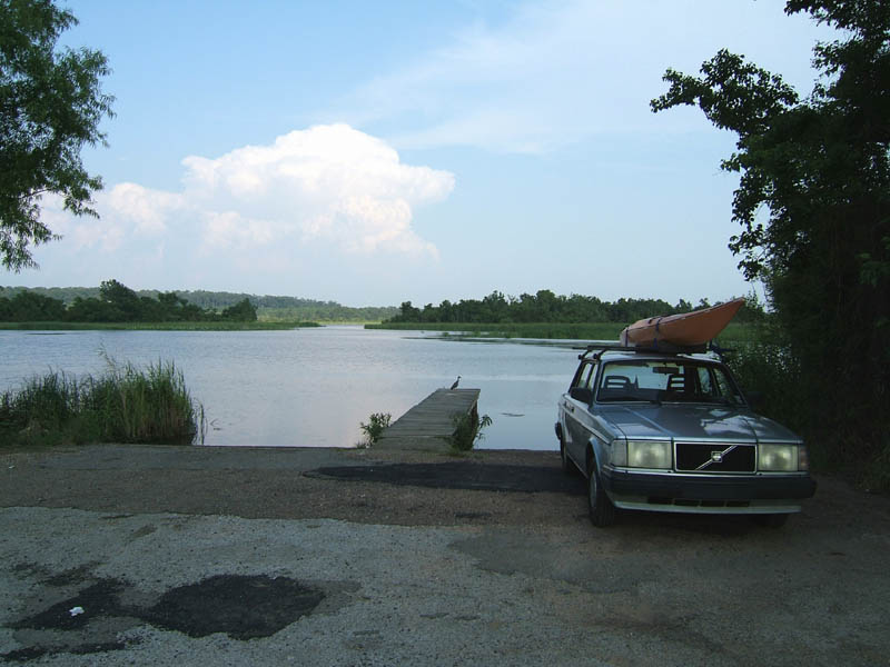
Weather: Sunny, slight morning haze, very little breeze out of the northeast with temps in the 80s. It was a bit humid.Luscher Park (sometimes spelled Lusher Park), is a free boat launching facility giving the public access to upper Dog River, but is rarely used by kayakers. Why? Last time I used the facility for kayaking was about 3 years ago. Mike will remember that trip – in a torrential storm that lasted for hours. We finished the paddle fighting a flood current and dodging a parade of trash floating down Dog River. Based on people, vehicles, and behavior at the launch site back then, I got the feeling that Luscher Park was not a safe place and that something was not right.
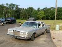
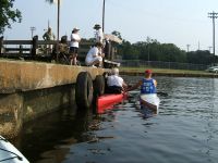
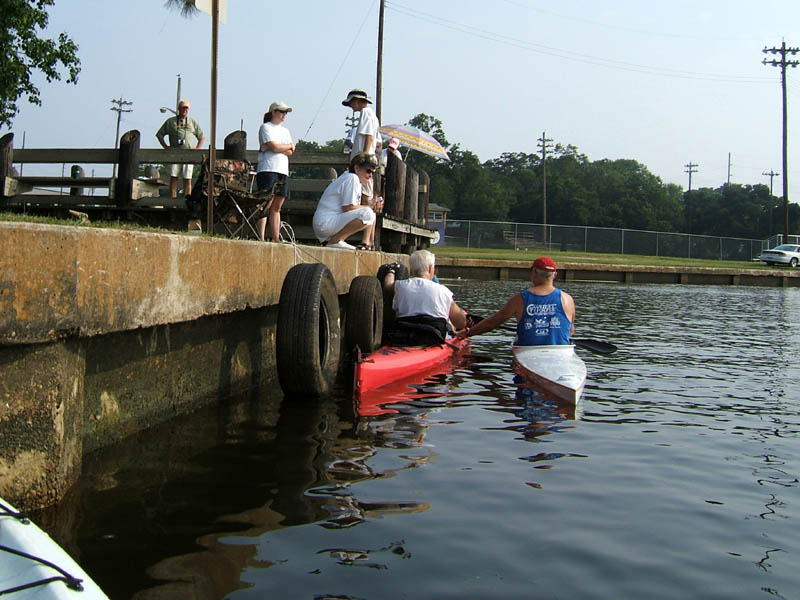
(1) Above left. I was hoping that my first impression of Luscher Park was skewed. First thing I saw after arriving for the Dog Paddle was an abandoned vehicle with two flat tires, a crunched in windshield, nearly blocking the entrance to the boat ramps, plus a beer bottle on the ground next to it. I’ll stick with my first opinion. Both times at this launch site, I observed vehicles driving across the park grass and stopping along the woods in the background of this photo. What were they doing back there? Drinking? Was someone selling Meth out of the woods? Was there some sexual deviants doing unnamed activities in their cars with each other, or in the woods? Most homes in a nearby neighborhood have steel bars covering all their windows. Trash lined the banks of the river. One woman kayaker spent quite a while picking trash out of the water and filling garbage bags because this site was trashy. While trash can originate far upstream, I still get an uneasy feeling about Luscher Park and would not recommend kayaking from this site alone. Please note, this is just one person’s opinion. Luscher Park might be a great place, so don’t let my opinion sway your desire to kayak in Dog River or let it affect your decision to participate in future Dog Paddles. The Dog Paddle event itself was well organized and it is a delightful kayak event for all kayakers. Where were all the Mobile Bay Canoe and Kayak members?
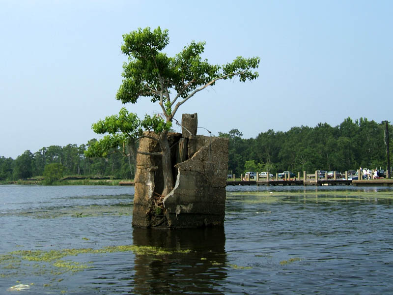
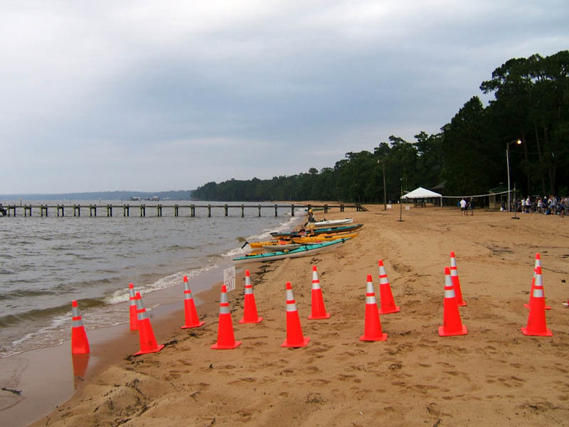
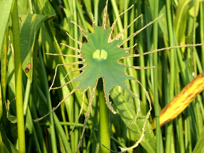
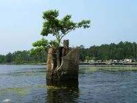
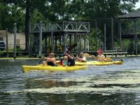
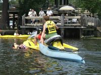
(2) Above right. When looking out over the water from Luscher Park boat ramps, one distinct sight is a tree growing out of a concrete pillar or so it looks like from the docks. When you look at it from the opposite side, the tree does have a little bit of soil to live off of, but it is still a remarkable sight. The triple boat ramps can be seen in the background. Trash can be seen in the water. With all the people around today, I wasn’t concerned for safety. What was concerning was the grass and weeds growing in the shallow water – not a good condition to have for racing a pedal boat. Luckily, the course was situated in such a way that it could be navigated without having to kayak through much grass.

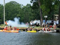
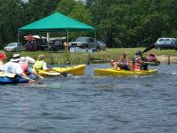
(3) Above left. Races, like this last race of the day (parent-child) began with the sound of a cannon going off. The man in the blue shirt with his back to you (in front of the pine tree), was setting off the little cannon, seen by his left foot. It was amazing to see such a little cannon blow out such a wad of smoke and create such a huge bang. People had to hold their ears, and those who were not prepared for the start of races, probably stained their underwear. (4) Above right. This parent-child race came down to a photo finish. There was some controversy over whether two parents could propel a kayak in a parent-child race against a kayak where a child was paddling.

(5)(6) 
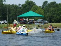
Above left and right. The parent-child race ended with a barrage of water flying between the top finishers. Anytime you see parents acting like children, you can tell a fun time was had by all. Controversy? What controversy? BTW, Roland, in the black shirt, won most of the races. Go MBCKC!
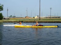
(7) Above left. Believe it or not, there were two other Hobie Mirage pedal kayaks in line for the two mile race and the couple in the tandem kayak (Mick & Mary Jean) was eyeballing those pedal kayaks closely. Two individuals were just test pedaling the Hobie Outbacks and only did about one lap of the four lap race before giving up and returning to shore. Oh yes, pedaling a Hobie is good exercise! There were a lot of different kayaks and canoes available for anyone to try out and even race if they wanted to. So, the big question is, how did I do in the races with the Hobie Outback? Based on unofficial results, I placed 4th in the 1 mile event, and 5th in the 2 mile event. I was barking mad because it was a ruff ruff race and I didn’t even get a dog bone. Heheheh. I was averaging about 5 mph and did beat most of the other recreational kayakers including several tandem kayakers. (8) Above right. (William & Kim) Hate to be one to give excuses, but when you have experienced racers in long 17-19 foot narrow kayaks compete against a 12 foot long wide pedal kayak, there is no race except between the long narrow kayaks. I heard one racer comment, “with the low cost of the awards (varnished dog biscuits), the Dog Paddle races should have had awards broken down to current kayak racing standards so the races would be fair to everyone.” I agreed, saying, “Pedal boats should have their own division.”

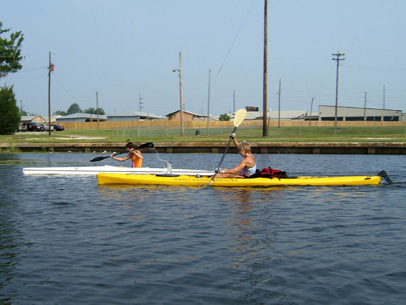
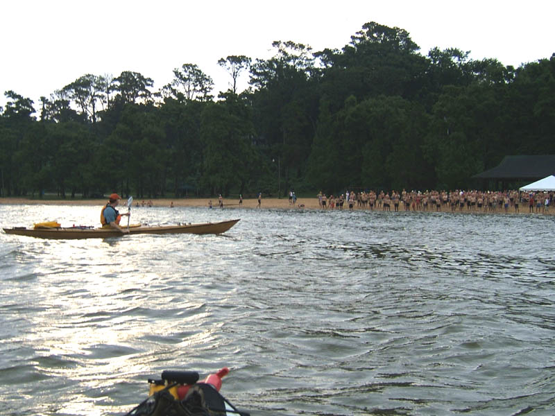
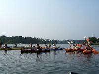
(9) Above left. The women were getting lined up for the start of their early morning race. 
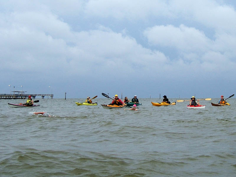
(10) Above right. It was no surprise that the two ladies (Alicia andNancy) struggling to cross the line first in their close photo finish race, were using long narrow racing kayaks. There should have been awards for those racing in much shorter kayaks as well. Tammy deserved one! The Sound Rowers Club out of the Seattle Washington area, recognizes over a dozen different kayak racing classes. Participants race against others in similarly rated kayaks, rather than pit a long fast kayak against a short slower kayak. http://www.soundrowers.org/
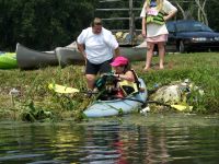
(11) Above left. The Dog Paddle races were not without minor incidences. While other Dog race participants were waiting at the starting line, this dog, Bud refused to get in the kayak with Sandy. This photo also highlights all the ugly trash that was lining the bank of Dog River. (12) Above right. In the Parent-Child race, something happened to a kayak not far from the finish line causing Mom and Child to take a cool swim. The Auxiliary Coast Guard boat, and Alabama Marine Police boat, on site, never even came over to see what was going on. Did they even know there was a little baby (barely visible in the life vest that Mom was holding) in the water? Thankfully, a photographer on a jet ski pulled Mom and Child, and Kayak to shore.

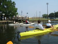
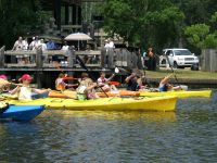
(13) Above left. Shot of the beginning of the Parent-Child kayak race with the nice park facility in the background that served as starting line and awards center. 
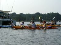
(14) Above right. This was the beginning of the women’s race. As in the beginning of most races, water was slinging, and kayaks were bumping as everyone tried to establish their line of direction while maneuvering to avoid patches of shallow grass in the water.
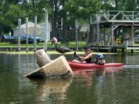
(15) Above left. There were only three kayaks in the Dog race. I give my most photogenic award to Stacie and her dog Camper. If you take a close look at the dog, it looks like it has a gray moustache and goatee, plus it is wearing purple sunglasses and a cape. It was the cutest thing and this dog was at home on the water. (16) Above right. It was billed as the most intense moment of the kayak race when this cool dog shifted in the kayak and appeared ready to take a leap for the spectator duck. It would have been a real featherweight bout that would have quacked everyone up. Luckily, race participants and spectators managed to duck from potential disaster and all finished as dry winners.

Tuesday, June 21, 2005

06/21/2005 – Tuckers to Greenwood Bayou

Launch: Tuckers Launch (now Brooks Park) which is a little less than a mile south of 158 on US-43 just south of Saraland. Launch Fee: $1. Route: Southeast down Chickasaw Creek to Greenwood Bayou and back. Distance: 6.7 miles. Average Speed: 3.7 mph. Time: Approx 2 hrs. Pace: Moderate with sprints. Weather: Sunny, slight breeze out of the southeast with temps in the 90s. Not very humid though. This was to be a pleasant after work paddle. It was nice, except for about a mile where the air had the strong stench of raw sewage. The smell reminded me of the books,
"Floating Logs" by Lucy Poo Waters,
"Tipping the Outhouse" by John Turner,
"Making a Stink" by Seth Pool,
"Mystery in Prichard" by Hoo Flung Dung,
"Dishonorable Discharge" by Paul David.
(The City of Prichard is one of Alabama’s Dirty Dozen of which Paul David is Utility Chief.
http://www.aeconline.ws/Dirty%20Dozen%20Info.htm
Prichard let TENS of MILLIONS of gallons of raw sewage flow into Mobile Bay. Mobile Baywatch filed a lawsuit last year to try to force Prichard to fix their raw sewage leaks. Paul David was recently convicted of the sewage spill and fined a grand total of $3,000 out of a possible 3.9 million dollars.) http://www.al.com/news/mobileregister/index.ssf?/base/news/1119086283211150.xml&coll=3
All I can say to the whole matter is, Pew, something stinks!

(1) Above left. There were a few things on this trip that stood out. First, some of the junk Tugboats that have been tied up on the side of Chickasaw Creek for a long time, are gone. Another item missing was the LST-325. In its place were two reely big spools of large pipe sitting on a barge. The photo doesn’t quite capture the size of those spools. (2) Above right. Further down Chickasaw Creek was the California sitting at a dock. The California is one of the most powerful hydraulic electric dredges in operation in the US. http://www.gldd.com/TempMain.asp?category=FLEET&title=California&subCat=Cutter

(3) Above left. At the entrance to Greenwood Bayou, the lower stems of some type of grass seemed to glow from the sunlight of the setting sun. (4) Above right. The crooked shadows of bare trees reflect in the water making this photo look like an oil painting.

(5) Above left. The odd looking photo that looks like the decaying thigh bone of some deer like animal is actually a tree stump. Hidden in the recesses of the tree stump are fiddler crabs. If you would like to see some fiddler crabs up close, visit http://www.fiddlercrab.info/uca_video.html. (6) Above right. The jagged cloud path from a jet trail made it look like the sun was setting erratically, sinking over the horizon like burning fireworks.

(7) Above left. The sun reflects over Black Bayou. (8) Above right. The sun, gobbled by Mississippi clouds, leaves a slight burning tint on Chickasaw Creek. I love watching the sunset from the water.

Sunday, June 19, 2005

06/19/2005 – Dauphin Island / Sand Island Club Trip

Launch: Protected area by rock jetties far southeast end of Dauphin Island. Cost: Free. Route: Southwest to Sand Island, then to Dauphin Island Pier, then return to launch site. Distance: 8.7 miles. Average Speed: 3.1 mph. Time: Approx 3 hrs. Pace: Slow mixed with sprints. Weather: Sunny with a steady 10-15 mph wind out of the northeast. 1-2 foot chop after getting away from land.

(1) Above left. I got to Dauphin Island a few hours before the club kayak trip in order to enjoy the sunrise. Took the time to practice sailing the Hobie. It was the first time I had ever aimed at something and tried to reach destinations. It got rather rough when the winds kicked in over 15 mph. The Hobie was sailing at 3.5 to 4.5 mph. (2) Above right. After about 4 miles of sailing, I put up the sail and waited for any club members to join the trip to Sand Island. I had no idea today was Father’s Day – not a good day to schedule a morning kayak trip because Dads have other priorities. At 8:00 am, I looked back one more time and still saw no kayaks, so off I went to Sand Island. I was standing on the south tip of Sand Island, panting hard trying to catch my breath after surfing waves for 29 minutes. What a morning workout. It was time to cool off and do some shell hunting.

(3) Above left. A seagull about to have breakfast and it ate the whole thing in one gulp. (4) Above right. Not sure what this accordion like object was.

(5)(6) Above left and right. While walking along the sand, what appeared to be flies taking off as I walked by them, were not flies, but beetles. Here are two shots of tiger beetles engaged in some intimate activities. Tiger Beetles are endangered in some areas of the country.

(7)(8) Above left and right. Birds, birds, and birds, as far as the eye can see.

(9) Above left. It is a good thing no one showed up today. The winds out of the northeast were pushing the water up into Pelican Bay. Despite the calm look of the water, there was some good current running under the Public Pier, heading west. Plus, because the winds were out of the northeast, the north shore of Sand Island had a pretty good chop, enough to cause waves slapping the side of the kayak to get me soaked. The trip along Sand Island was no fun, and then it was fighting current all the way back. (10) Above right. Parting Shot: I found it ironic to see trash on the beach, from a company that manages our waste.

Saturday, June 18, 2005

06/18/2005 – FYC / Grandman / Point Clear

Launch: Fairhope Yacht Club. Route: South along the Eastern Shore to the Fairhope Pier. Members of the Mobile Bay Canoe and Kayak Club were helping swimmers in the waters of Mobile Bay during the swimming portion of the Grand Man Triathlon. After the event, I went south to the Grand Hotel and back to FYC. Distance: 21.5 miles. Average Speed: 3.0 mph. Time: Approx 7.5 hrs. Pace: Slow except for a few early morning wind sprints to catch waves. Weather: Cloudy with light sprinkles and distant thunder in the morning. It cleared off by mid morning, and then clouded up again in the afternoon. Warning! There is an XXX Photo Below. You have been warned.

(1) Above left. A few kayaks sit lined up along the beach. The beginning of the Grand Man Triathlon race, hosted by the Mobile Bay Watch http://www.mobilebaywatch.org/ organization, was still twenty five minutes away. Mobile Bay Watch is helping to protect the beauty, health and heritage of the Mobile Bay area. Please consider supporting them. (2) Above right. Steve rests in his kayak, waiting for the first wave of swimmers in the triathlon to take to the waters. http://www.thegrandman.com/triathlon.html

(3) Above left. The swimmers receive their instructions and I believe there was also a moment of silence for Larry McDuff who was recently killed by a hit and run driver while riding his bicycle. (4) Above right. Roland, Brint, and Harriet keep an eye on swimmers while they make the turn to head back into shore. Harriet organized the kayaker participation for this event and she did a fantastic job.

(5) Above left. Mobile Bay Canoe and Kayak club members, despite the poor weather, provided swimmers with a bow to hold on to if they needed to catch their breath. Here, the last two swimmers had a Grand escort back to the beach in the slightly choppy conditions in the Bay. (6) Above right. George, in his white wooden kayak, passes by one of the swimmer course markers as the horizon darkens with the hint of an approaching storm. The rain squall was brief. The winds kicked up a few nice waves to surf with the kayak, but they quickly abated.

(7) Above left. After the races, I headed down to the Grand Hotel (http://www.marriottgrand.com/) enjoying the sun that finally appeared after the front passed. There was a lot of construction activity going on to repair or replace damaged docks on the trip south. I thought the pilings had to be driven in by a crane with a pile driver. Wrong, here, pilings are being sunk six feet into the sand with the aid of a water hose connected to a long PVC pipe, and a compressor. The forced water blows a hole in the sand allowing the pile to sink. (8) Above right. As promised, here is your XXX photo. Who knows where this XXX photo was taken (approx GPS coordinates)? Five points to the first person who answers correctly.

(9) Above left. Crew aboard the Kaotic seemed perplexed as they passed by me. Apparently, they had never seen a Hobie Outback before. There wasn’t much wind for a boat to sail today. (10) Above right. Heading back to the Fairhope Yacht Club http://www.fairhopeyachtclub.com/ I passed by some small sailboats and because there was little wind, I pedaled circles around them. Here, this young fellow gazes at the Hobie like he has never seen one before. What a splendid day.

Wednesday, June 15, 2005

06/15/2005 – Meaher Park to Ducker Bay

Launch: Meaher park public boat ramp. Cost: Free. Route: Meander around Ducker Bay. Distance: 2.6 miles. Average Speed: 1.8 mph. Time: Approx 1.5 hrs. Pace: Slow. Weather: Sunny with thunderstorms forming off in the distant north, east, and west. Temp in the 90s with high humidity. Knowing there is a lot of grass floating on the waters along the causeway, I decided to take the paddle kayak (Necky) rather than the pedal kayak (Hobie), out for a short after work trip.

(1) Above left. A heron sits on the dock watching and an alligator swims along the bank (out of view in this photo), both waiting on handouts. Someone obviously feeds the alligator that hangs out by this dock because it has no fear of humans. (2) Above right. The Meaher Park boardwalk is not seeing many visitors because it is still in a state of disrepair.

(3) Above left. This is what is left of a huge Lotus flower leaf. What could have eaten such a large leaf? (4) Above right. It is large southeastern lubber grasshoppers that eat vegetation. Their poop (round objects on leaf) is about as big as rat poop. Sorry for the crappy photo. Anyway, for those interested, American Lotus flowers should be starting to bloom in the next week or two.

(5) Above left. Having been kayaking in mostly deep waters to accommodate the pedal kayak, it felt odd to be paddling across pond scum and along the shallow areas of Ducker Bay. Sure have missed regular kayaking. (6) Above right. A damselfly makes itself right at home on the pond scum.

(7) Above left. An odd looking flower coming from a stalk among the thick water grass. There are also two empty insect shells on the right, and some sort of insect that scoots along on the water (perhaps a strider?). (8) Above right. The sun gets ready to snuggle up behind the clouds.

(9) Above left. Meaher Park boardwalk bridge that spans Ducker Bay, on the west side looking east. (10) Above right. Same boardwalk bridge, only now on the east side looking west. This was a real pleasant after work paddle. All the stresses of work melt away when I breathe deeply while enjoying the solar light show. I’m going to do this more often.