Monday, February 28, 2011

02/28/2011 - Around Pinto Island

Launch: Shirley's (US Hwy 90 across from battleship USS Alabama)
Launch Cost: Free
Destination: Mobile River going south around Pinto Island. You can't get all the way around Pinto Island because the upper side is blocked by vegetation.
Distance: 12 miles (round trip)
Paddle time: 3-1/2 hours
Weather: Cloudy, 70 degrees, winds 10-20 mph. Tide rising and current about 1 mph.
GPS Track: To view or download the GPS track of this trip, Click Here.


Header Image

1) Today's destination was over near those buildings on the skyline.

2) Down around the corner of Pinto Island are some massive cranes that move a lot of bulk steel using powerful magnets. The steel is probably headed up Mobile River by barge to the steel plant ThyssenKrupp.

3) When current and wind are going in the same direction, the waves are smaller than if they were opposite. Even though winds were gusting up to 20 mph and there was a small craft advisory, conditions were fine for kayaking in Mobile River.

4) The USS Alabama. Despite its tourist attraction, kayaking around the Battleship north to just past the Hwy 90 bridge can be unusually choppy, rough, and unpredictable. I consider it one of the more dangerous places to kayak in this area.

5) If you have every tried to buy a plane ticket for a flight that leaves out of the Mobile Airport, then you know if you fly from Mobile, you will get definitely get "Poor Faster." This is a takeoff on the Mo Faster ad.

6) For you poor people with snow on the ground, good news - spring green is on the way.

7) A different perspective on the roads used to drive across Mobile Bay.

8) Bet that bird will be in for a surprise when a maintenance person lowers the light housing to replace a bulb.

9) A rather cloudy sunset.

10) Conditions did deteriorate between the Battleship and the Hwy 90 bridge where the wild confused waves with the current stir up a froth. Plus, waves hitting the Battleship bulkhead also cause froth. This is the incoming current froth line.

11) I mentioned a few possibly dangerous areas that can throw you surprises when kayaking the Mobile River loop. Thought a graphic of the approximate location of those areas, shown in red, might help. This is the track from this trip.
There have been times that I paddled all day in wonderful conditions only to approach the above areas in red and was thankful just to get past them without capsizing. It may look like I go kayaking where ever I want when ever I want. This is not true. I do not go kayaking without checking a half dozen different forecasts. I time trips so I pass potentially difficult areas at optimal times.  What is checked are tides, current wind from buoy locations, forecast wind speed and direction from the Aviation forecast, water temperature, marine forecast, current forecast for max ebb and max flood, upstream water levels, and if going into the Gulf, I look at swell forecast. Hope this helps new kayakers. Be safe - wear your life jacket and have both plan A and plan B in case there are problems.

Thursday, February 24, 2011

02/24/2011 - Eastern Shore Mobile Bay

Launch: Volanta Avenue right of way access (next to Fairhope Yacht Club)
Launch Cost: Free
Destination: Fly Creek and Mobile Bay
Distance: Approx 9 miles (round trip)
Paddle time: 2-1/2 hours
Weather: 65-70 degrees, cloudy becoming sunny. Winds 10-15 mph. Tide and current were minimal.

I picked up the replacement Mirage Adventure hull from Hobie at Fairhope Boat Company this afternoon and couldn't wait to test it out. If you want to buy a kayak from a company that stands behind their kayaks, you should buy a Hobie! I love the fact that this stable pedal kayak goes faster than a narrower paddle kayak.

1) It was totally cloudy at launch and a bit breezy out of the southeast. The horizon began to brighten down by Point Clear.

2) During the pedal trip, the clouds gave way to blue sky.

3) The new Hobie Adventure hull performed wonderfully in light choppy seas. Even though I was soaked from crashing waves, the inside of the hull was dry.

4) Under the Fly Creek Cafe sign it says, "Find Your Happy Place." Sitting in the seat of the Hobie Adventure is definitely one of my happy places. :) Hope you find your happy place.

5) A dog appeared out of thin air and about scared the poop out of me.

6) I later saw how the dog appeared out of thin air...

7) Pelicans hang out near the entrance to Fly Creek.

8) A lazy time for this pelican.

9) Odd looking clouds.

10) Sunset on Mobile Bay with the Fairhope Pier in the background.

Wednesday, February 23, 2011

02/23/2011 - Mobile River Loop

Launch: Causeway Boat Ramp (just west of Oysterella's restaurant)
Launch Cost: Free
Destination: Mobile River Loop
Distance: Approx 21 miles (round trip)
Paddle time: Leisurely 7 hours
Weather: 60-70 degrees, partly cloudy to sunny in afternoon. Incoming tide, winds calm to light. Minimal currents. Just about perfect!

Are you getting tired of hearing bad news about what is happening somewhere else in the world? If you like to get a little exercise and enjoy nature, Kayaking can instantly cure the world's troubles - at least until you get back home and turn on the television... Interested in Kayaking but have never done it? Do an internet search for a kayaking club near you. Many kayaking clubs have public meetings, including the one in the Mobile Bay area. Go to a meeting! For the local club, click here: Mobile Bay Canoe and Kayak Club

Header Image

1) I started paddling about an hour before sunrise with some illumination by the moon.

2) Sunrise across Delvan Bay was stunning. I mostly sat still for over an hour enjoying the changing colors on the reflective waters and took about a hundred photos - way too many to put on blogger.

3) Hmmm, one Osprey eagle was bouncing up and down on top of another Osprey.

4) Wow, look at the claws on Osprey eagles. Ya gotta feel sorry for the Osprey on the bottom.

5) Saw many long beaked birds all along the shoreline. Think this is a Snipe or a Dowitcher - never can tell them apart.

6) Young White Ibis. Even saw a juvenile bald eagle today.

7) Yes, this alligator was alive. Even though I was close, it just did not want to get back into that dirty cold water when the sun was making it feel so good. 

8) Right now is a good time of year to see alligators up close.

9) Mobile River has big ship traffic like this Strait of Dover cargo ship.

10) If you paddle around big ships, stay at least 100 feet away from them. Why? Water could start pumping out of the hull at any time knocking you over if you are too close.

11) The small little island southeast of the USS Alabama, called Goat Island, is a hangout for local and migratory birds.

12) You can see the normal growth on the beak of these male pelicans. For more photos and info about white pelicans, Click Here.

Saturday, February 19, 2011

02/19/2011 - Lower Crab - Conway Loop

Launch: Shirley's (US Hwy 90 across from battleship USS Alabama)
Launch Cost: Free
Destination: Lower Crab Creek, Conway Creek and Red Maple Slough
Distance: 14.5 miles (round trip)
Paddle time: 4-3/4 hours
Weather: Sunny, 70 degrees, winds 5-10. Tides minimal, near neap. Current minimal.
GPS Track: To view or download the GPS track of this trip, Click Here.


Header Image

1) Had planned to do the Mobile River loop but decided to stay in calmer waters today. It was pretty in Lower Crab Creek.

2) Pelicans taking off in Polecat Bay.

3) Gulls on the move.

4) Saw two Eagles today. Looks like this one has taken over an old Osprey nest.

5) This river dog was of respectable size.

6) Taking a stretch and snack break. I planned on coming back in the dark - hence the 360 degree light.

7) Blackbirds resting on an old duck blind to watch the sunset on Big Bateau Bay.


8) Mardi Gras colors on the downtown buildings. This was a wonderful paddle!

Friday, February 18, 2011

02/18/2011 - Black Creek

Launch: William Brooks Park (US Hwy 43 at Chickasaw Creek – Southwest Corner)
Launch Cost: $4
Destination: Black Creek
Distance: About 18 miles (round trip)
Paddle time: 5 Hrs 30 Minutes
Weather: Very Foggy , winds calm to 5 mph. Air temp 55-70 degrees. Tide falling. Current minimal except in Mobile River where it was running about 1 mph. Water temp about 50 degrees.
GPS Track:
To view or download the GPS track of this trip, Click Here.


Header Image

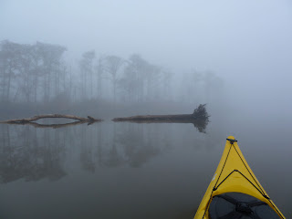
1) Every year I like to kayak in foggy conditions. That way I won't get freaked out should a fog bank ever descend unexpectedly. On this trip, the first hour paddling in fog was in pre-dawn darkness. Both sound and smell was amplified. Was attempting to get a photo of tugboat lights in this shot but the camera focused on the kayak making the fog droplets look larger than life.

2) In Mobile River, visibility was about 1/4 mile. Could not see the other side of the river.

3) Brown Pelicans were sure numerous.

4) This is a strange photo of boat wake erosion eh?

5) Never can time the photo right to get the shot of an otter when it sticks its body about 2 feet out of the water. Also caught my first sighting this year of some alligators.

6) Ducks adapting to the industrial revolution.

7) I love the textures of lichen.

8) Big fish like to hang out near the treated sewage outflow (green water). What kind of food has the fish on your plate been eating?

9) During the last 20 minutes of the paddle, it went from cloudy to almost clear.

10) Creepy Photo - the reflection of this duck has 3 eyes.